It’s wild how many people just expect Google Maps to get them everywhere—on foot, behind a wheel, or on two wheels with a saddle. But ask a regular cyclist and the answers get heated. Some Melbourne riders swear by it, others groan when you even mention that pixelated blue line. Why the divide? It’s all about the details. Most apps just want to toss you from point A to B, but bikes have different needs—think safety, scenery, street surfaces, elevation, even low-traffic shortcuts. Let’s break down if Google Maps can really handle that, or if you’re better off with good old local advice and other apps. This isn’t one of those dry tech-overview articles either—these are insights you’ll use the next time you pull your helmet on.
Google Maps and Cycling: The Promise vs Reality
Google Maps launched its cycling directions back in 2010, and since then, it’s rolled out loads of updates. On paper, it looks handy—just click the little bike icon, toss in your start and end points, and boom, you get your suggested route with supposed bike paths, elevation profiles, and estimated times. Simple, right? Well, not always for Melbourne cyclists. The real-world experience often depends on where you’re riding and what you care about most.
Take Melbourne, for example. It's known for its sprawling bike path network—Capital City Trail, Merri Creek, Beach Road—but the city’s patchwork of bike lanes and tricky intersections make it a tough spot for digital maps. Sometimes, Google Maps shines, showing off a network you'd struggle to piece together without some digital help. You’ll spot suggestions for the Upfield Bike Path or even lesser-known cut-throughs that’ll surprise you. Other times, you’re rolling down Sydney Road with buses zipping past, wondering who at Google thinks that detour is a good idea. The main problem? Google Maps doesn’t *always* feel what it’s like to ride here. Sure, it knows bike lanes exist, but what about surface quality? Is that green line a painted gutter lane squeezed between parked cars and impatient traffic? Or a separated, tree-lined heaven for cyclists? It’s not always clear until you’re mid-ride.
The app does let you preview elevation via a profile graphic. But don’t count on it warning you about every sneaky uphill. Some riders in Northcote or Brunswick have found themselves pushing uphill while the app breezily claims it's 'mostly flat'. Weather, wind, and street closures also mess things up. Google’s done a better job marking ‘Bike Friendliness’ in some areas, but construction sites or new pop-up lanes (hello COVID years) don’t always get updated as fast as we’d like.
But it’s not all doom and gloom! For most basic commuting—especially into the CBD, uni campuses, or those Sunday rides out to St Kilda—Google Maps usually picks logical, on-bike routes. If you don’t know Melbourne well, it’ll keep you mostly off grim arterial roads. If something isn’t right, it’s usually only a minor annoyance. Seasoned cyclists will double-check on Strava or MapMyRide, but as a baseline tool, Google Maps gets the big things mostly right—just don’t expect it to have a cyclist’s intuition yet.
The Hidden Perks and Genuine Headaches
Let’s talk about the little things—the perks and the face-palms. One thing Google Maps nails is the ability to mix and match modes. If you’re planning a long ride but know the train's your backup, you can drop a pin at a station and snap up multi-modal directions. For newbies, being able to preview your entire route in Street View is priceless, turning any confusing intersection into a more familiar sight before you’re in the thick of it. That’s huge for first-timers who don't want to get lost at weird roundabouts or hairy intersections (looking at you, Elizabeth Street…)
Another bonus? Google Maps almost always shows you the fast way, the flattest way, and lets you tweak the waypoints. Playing with your route by dragging lines on a desktop lets you avoid streets you know are rubbish or to test an alternative. But beware—sometimes a drag lands you on a dead-end or awkward pedestrian-only bridge. Their “avoid ferries” option is a classic (hi Westgate Punt fans!) but you can’t ‘force’ Google to stay off busy trucks-only roads unless you manually patch together a Frankenstein route.
And here’s a headache: Real-world cycling conditions can turn a suggested green line into a stress test. For instance, Google will send you up Heidelberg Road or punt you across Moonee Ponds Creek Trail at peak hour. But it doesn’t know that regular trams and driveway traffic make your ride far from chill. Melbourne’s famous weather can produce nasty winds without warning, but Google has no clue you’re about to be blown sideways along the Maribyrnong.
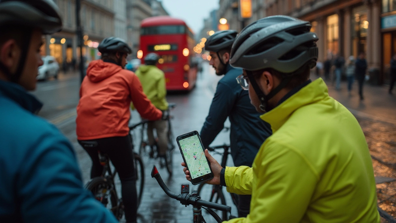
Navigation mid-ride is another mixed bag. Most of us pop a phone in a handlebar mount and trust the voice prompts, but Google Maps doesn’t always give you enough heads-up before a turn. It’ll buzz “turn left” while you’re already darting past your street, especially in the winding Fitzroy lanes. And try reading a screen with wet fingers mid-drizzle. Nighttime is a special challenge. The app’s night mode helps, but watching your route and the road’s potholes is tricky. If your phone battery isn't up to scratch, a long ride with Google Maps can drain you dry before you even spot the city skyline on the horizon.

Tips for Getting the Most Out of Google Maps on Two Wheels
If you know Google Maps isn’t perfect, you can turn its quirks into strengths. Experienced riders in Melbourne hack the system—sometimes quick, sometimes with a bit more work. Here are some favourite tricks:
- Double-check bike paths: Don’t trust the app blindly. Before you roll out, zoom in on anything marked as a bike path. Use Street View to check if it’s really separated or just a painted illusion.
- Customize your route: Don’t let Google bully you onto main roads. On desktop, drag the route onto quieter backstreets you know work better. Try adding a stop at a park or a cafe to force the app into a more scenic, safer course.
- Keep the phone charged: Invest in a handlebar phone mount and take a powerbank. Google Maps guzzles power with constant navigation, especially over long rides and with the screen at max brightness.
- Download offline maps: Melbourne’s suburbs aren’t all blessed with 5G. Offline maps mean you don’t get stuck staring at that endless blue circle waiting for routes to load as your mates roll off ahead.
- Local Facebook or Reddit groups: Tap into real-time insights. Cyclist groups on Reddit or Facebook often know about construction, pop-up lanes, or shortcut legalities Google hasn’t yet caught up with.
- Mix apps: Use Strava for crowd-sourced heatmaps (showing popular bike routes), then overlay your chosen path into Google Maps for navigation. Komoot is another solid app with cyclist-focused routing.
- Use ‘bike’ mode year-round: If you stick to car mode out of old habit, you miss secret laneways, formal bike boulevards, and scenic stretches that Google reserves for two wheels only.
- Be cautious with time estimates: Don’t believe Google’s ride-time prediction if you’re carting gear, battling a headwind, or just new to riding. Padding your ride time makes sure you aren't in a rush and can enjoy the trip.
- Report errors: It takes a few taps to let Google know if a bike lane vanished or a path is closed, but it helps the next rider.
If you genuinely want Google Maps to work for cycling, you’ve got to work the system and stay flexible. Melbourne’s street maze can throw up fresh challenges—construction, a dodgy bit of tarmac, a spontaneous event blocking the bike lane—so it's smart to always have a Plan B. Keeping a sense of curiosity isn’t a bad idea either; the best rides often happen when you nudge away from Google’s main route for something fun or unexpectedly quiet.
Should You Trust Google Maps for Your Next Ride?
This is what it comes down to: Google Maps is a handy tool, but it’s not the cycling bible. If you know your way around Melbourne or you’re just city-hopping between suburbs, it’ll cover you about 90% of the time. For random detours into the sticks or when you want a stress-free pedal, it’s only as good as your willingness to double-check and tweak your route. The more riding you do, the more you see Google’s quirks—some streets marked as ‘bike lanes’ are really just cluttered gutters, while the backstreet gems beloved by locals might never make it onto the official algorithm. The app’s strength is its total coverage and regular updates, but it’s just not tuned with that sixth sense cyclists develop over years on the saddle.
If you’re riding for exercise or adventure, pairing Google Maps with something like Strava’s popular segments or Komoot’s tailored rides is a real upgrade. The truth is, Melbourne’s cycling scene is always changing—council pop-up lanes after lockdown, wild weather that flips your planned route, and new trails getting added every year. Technology can only do so much. Your best rides are a mix of digital guidance, old-fashioned curiosity, and the odd bit of chutzpah. Don’t be shy about asking for a tip at your local bike store, or following another rider’s route home from work if it looks good.
So, how good is Google Maps for cycling? Let’s call it ‘useful, but far from perfect’. It’ll get you moving, keep you on mostly the right track, and maybe even show you a few shortcuts you didn’t know existed. Stay alert for its limitations, hack it wisely, and know when to ignore the blue line and chase the better view. That’s where the real magic happens—when tech and Melbourne streets collide and you ride that sweet spot in between.